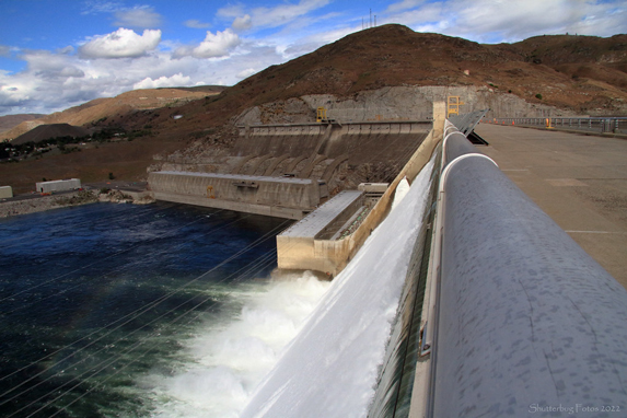
Feds update Columbia River Treaty flood risk management
Watch
Listen
(Runtime 1:04)
Read
The U.S. and Canada are working out key details of the Columbia River Treaty. That important agreement details flood risk management along the mighty Columbia, along with other operations. Now, the two governments have drawn up potential plans to help manage the river flow.
“We want to be clear that life and safety is paramount and that we still have a right to access additional storage space in Canada,” said Brig. Gen. William Hannan, with the U.S. Army Corps of Engineers.
The U.S. Army Corps of Engineers and Bureau of Reclamation hosted virtual information sessions on updated flood risk management plans on Dec. 4 and Dec. 5.
For 60 years, the U.S. paid Canada to store a specific amount of water in Canadian reservoirs to help protect people downriver, after devastating floods in the U.S. In 1948, nearly 40% of water in the Vanport Flood came from Canada, according the U.S. Army Corps of Engineers.
However, the treaty terms changed Sept. 16. Now, the two governments are updating the treaty terms.
A big part of that includes flood risk management. Water managers say the U.S. will have less storage in Canada — but managers will be able to call in real time if more storage is needed.
“To maintain similar levels of flood risk, U.S. reservoirs may need to make up some of the lost storage from Canada in some years,” said Steve Barton, who is with the U.S. Army Corps of Engineers.
Starting in 2025, the Arrow Lakes Reservoir in Canada will store 3.6 million acre-feet of water for flood control, Barton said. The treaty agreement in principle will continue through 2044, he said.
“Arrow Lakes Reservoir is the most critical Canadian reservoir for flood risk management due to its large size and its position just north of the border,” Barton said.
With the new operations, Grand Coulee Dam could sometimes see deeper and longer water drawdowns for a few weeks at a time, Barton said. These changes could cause interruptions a few weeks a year, depending on whether the river is higher or lower.
Storage changes could make it more expensive for tugboats to navigate upstream. Drawdowns could expose archaeological sites when waters are lower.
“When these archaeological sites are exposed in the drawdown zone, they are more vulnerable to shoreline erosion, mass wasting and looting,” said Eric Rothwell, with the Bureau of Reclamation.
Changes in water flow could also affect the seasonal timing of pumped irrigation.
Lake Roosevelt drawn downs could make it difficult for the Confederated Tribes of the Colville Reservation’s Inchelium-Gifford Ferry to traverse the lake. That could mean a one-way trip around the lake takes roughly 45 minutes longer to get to school or access emergency services.
“Currently outages are relatively infrequent and short in duration. This could change with additional reliance on Grand Coulee and Lake Roosevelt for flood risk management,” Rothwell said.
In the early spring and summer, boat launches could be unusable if water is low at Lake Roosevelt. That could also make other boat ramps busier.
The operations could affect tribal plans to transport salmon above Chief Joseph and Grand Coulee dams, but leaders said they plan to work with the Upper Columbia United Tribes. The phase two implementation plan is expected to take at least 20 years.
Managers said the changes shouldn’t increase water temperatures.
While the changes could mean adjustments for a few weeks out of the year, the flood risk management agreement is incredibly important, said Roland Springer, with the Bureau of Reclamation.
“Without an agreement, Grand Coulee and other reservoirs would have to be operated very differently for flood risk management,” Springer said.


