In Southeastern Washington, Geologists Dig Into The Past To Find Fault Signs Of Future Shaking
Listen
Just off the highway near Washington’s Tri-Cities, 20 miles southeast of Pasco, Steve Angster steps into a giant trench. In it, the U.S. Geological Survey geologist is hoping to find evidence of a fault line.
He looks out through the morning fog. It’s hard to see the surrounding landscape, but Angster knows it well.
“On a clear day you could see Rattlesnake Mountain, and then, we have what we call the rattles, which are those little buttes along the way,” Angster says.
Those buttes and the basin south were formed thousands of years ago from a fault – a fault geologists know very little about.
But they’re trying to learn more.
Worried About Cascadia, But…
“Everybody’s worried about (the) Cascadia (Subduction Zone),” Angster says of the fault that’s predicted to one day rupture and cause “The Big One.” It’s predicted to catastrophically damage land and infrastructure west of Interstate 5 in Washington and Oregon.
“But we have a lot of faults closer to home that pose a pretty significant hazard to the (nearby) communities,” in the Inland Northwest, Angster says. “Being that this is really close to the Tri-Cities area, we want to understand this better. How big of an earthquake can we expect from a fault like this?”
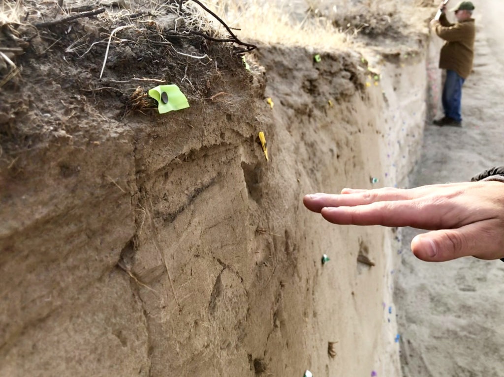
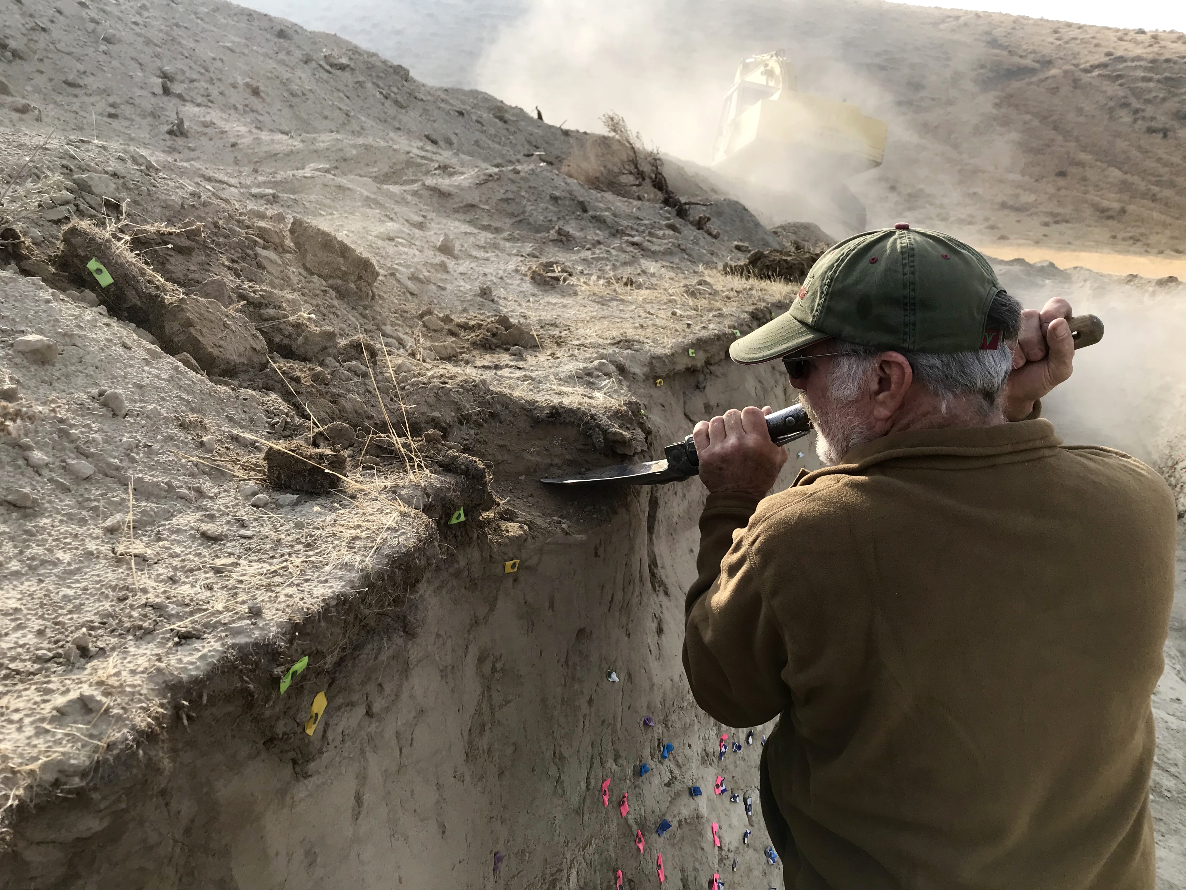
Geologists map the inside of the trench with flags. They can identify different features from the sediments, flagging important pieces of the trench wall. The yellow and green flags identify modern soil. At the bottom, blue flags identify deposits from the ancient floods of glacial Lake Missoula that helped create the channeled scabland landscape of the Inland Northwest. CREDIT: Courtney Flatt/NWPB
Unlike the Cascadia Subduction Zone, the faults in eastern Washington are in the upper crust, (the outermost layer of the earth). That means they’re closer to the surface and to communities. They may not produce as large of an earthquake as the subduction zone off the coast, but the earthquakes these inland faults can produce could significantly damage infrastructure in nearby communities.
Despite all the warnings about The Big One, among the largest earthquakes to happen in Washington shook communities east of the Cascade Mountains: a magnitude 6.8 near Entiat in Chelan County in 1872 and a magnitude 6.0 near Walla Walla in 1936.
The fault Angster is searching for could be a trace of that 1936 earthquake.
Help Of LIDAR
Back at the dig site near the Tri-Cities, you can actually see where the fault line might be. It’s what geologists call a scarp. To the average eye, it just looks like a slight rolling bump in the ground, but it’s actually where one side of the fault line has slid up relative to the other side.
With the help of LIDAR laser-imaging technology, Angster can follow this bump, or scarp, a little more than 12 miles. That’s from Wallula Gap toward Walla Walla along the base of Horse Heaven Hills.
“Since it’s a (suspected) fault scarp, we want to dig across it and figure out when did this rupture,” Angster says.
They’ve dug a 90-by-12-foot trench across the scarp. It’s mapped with pink, yellow and blue flags.
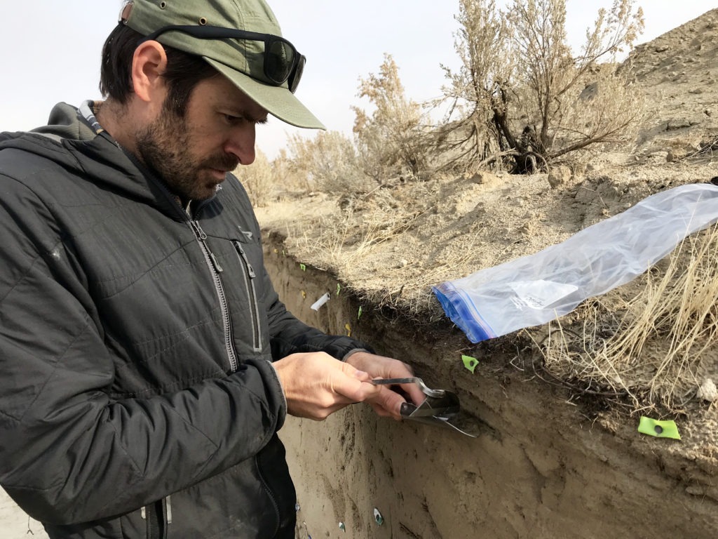
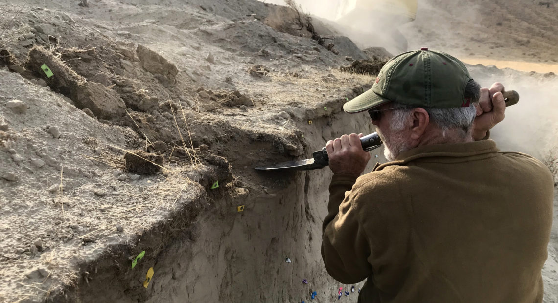
USGS geologist Steve Angster scrapes volcanic ash out of the trench and collects it in a plastic baggie. He can use the ash to figure more about when this scarp formed. CREDIT: Courtney Flatt/NWPB
“We clean it and then we study it for three weeks – we were sitting in this thing through the wind and everything. And this is pretty dusty material,” Angster says. “So we had some pretty crazy days.”
To Angster’s eyes, the barcode-like sediments inside this trench are like a history book. He can identify different features from the sediments, flagging important pieces of the trench wall. They know the fault scarp formed sometime after the Missoula floods, when torrents of glacial flood waters swept through the area some 15,000 years ago.
Geologists are hoping to learn more about fault lines east of the Cascades, like the one Angster is searching for.
They know of at least 10 fault zones in eastern Washington that are 40 miles or longer, according to Megan Anderson, an earthquake geophysicist with the Washington Geological Survey.
“Those are the faults that could rupture to produce an earthquake magnitude that is damaging to communities and of particular concern. That isn’t to say there are some out there that we don’t know about,” Anderson says.
Her goal is to one day map all the fault lines in the state. That way geologists can provide a risk assessment for people: the probability of when a fault line in each area is expected to rupture. Right now, they can mostly tell when a fault last ruptured on a geological time scale, over thousands of years.
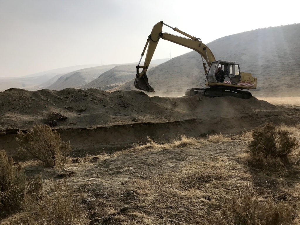
After the geologists are finished studying the fault scarp in the trench, they fill it back in. They plan to dig another trench in 2020 to study this geologic feature even more. CREDIT: Courtney Flatt/NWPB
But a risk assessment “(is) so much easier to understand than this one fault having an earthquake once every 2,000 years. How do we prepare for that? How do we even absorb that in our everyday lives? You know, useful for us geologists, but a little less useful for everybody else,” Anderson says.
In California, that sort of mapping took almost 100 years, but it should be faster in Washington technology is better now.
Some of the big faults geologists know about on the dryside of the state are near the Tri-Cities, Walla Walla, Chelan, Ellensburg and Yakima. You might recognize these landmarks they formed: Saddle Mountain, Umtanum Ridge and Rattlesnake Ridge.
“All of those ridges were uplifted. All of that topography was made by the faults that lie underneath them,” Anderson says.
They started work on a major mapping project this year in the Ellensburg area. The project could take up to five years.
“We’re in the middle of trying to understand how (faults) all work together, how active they are, all these different things,” Andereson says. “It’s a really exciting time in the science because it’s a really a big phase of discovery.”
And it’s important for people to be prepared, even if they’re not in danger of damage from The Big One, Anderson says. Emergency managers say you need to be at least two-weeks ready when a disaster hits, with enough food, water and medicine stocked away.
Carbon Dating
Outside of the Tri-Cities, geologist Steve Angster opens up a plastic baggie and scrapes tiny bits of dirt inside. He’s collecting ash from volcanic eruptions. The team hopes to date the carbon to know more about when this scarp formed.
They think it could date back 10,000 years.
“That puts this fault on our list as pretty active and potentially hazardous fault for this area,” Angster says.
They didn’t find the fault line in this trench, but Angster says they plan to keep on looking, hopefully digging again next summer.
“What we’ve found really in this trench is really good evidence for strong shaking,” he says. “We are at the very eastern end of this rupture or this fault trace. So it could be that we just have very little movement here. And so it could be very hard to see.”
Related Stories:
Some freeways may be useable following ‘the Big One’ per new modeling by UW
New modeling by the University of Washington of the impacts of a major Cascadia earthquake offers a less dire picture of the aftermath of the so-called “Big One” — specifically when it comes to highway bridges.

Concert in Pasco To Raise Disaster Relief Funds For Colima in Mexico
The Mid-Columbia Symphony will perform a public concert this September 24th in Pasco at 6:00 p.m. Photo from Mike Gonzalez reports website. Listen (Runtime 0:53) Read A symphonic concert will
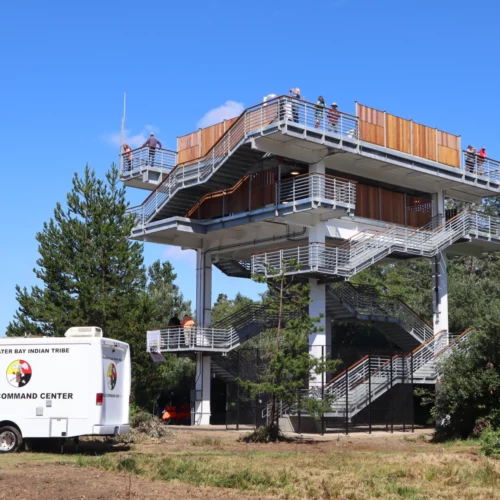
Coastal Washington Tribe Creates Higher Ground By Building Tsunami Tower, First Of Its Type Here
There is a new option to escape a tsunami if you’re on the southwest coast of Washington when the Big One strikes. The Shoalwater Bay Indian Tribe on Friday dedicated a 50-foot tall evacuation tower in Tokeland, Washington. Tribal leaders and the Federal Emergency Management Agency said the new tsunami refuge platform should be an example and inspiration for other vulnerable coastal communities.

